GPS-Denied Drone Autonomy
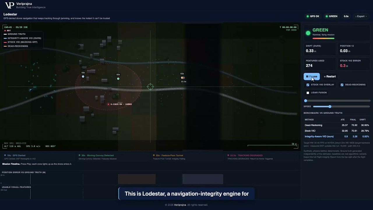
Lodestar is a navigation-integrity engine for GPS-denied flight. It keeps tracking through a jamming bubble to about 0.9% drift, and when the scene goes genuinely unobservable it flips RED and returns home rather than flying a confident-but-wrong fix into a wall. Trust is computed outside the estimator, so it holds no matter how good the underlying VIO gets.
0.92%
Position drift held through the GPS-denied leg (ours)
Seeded synthetic mission; dead-reckoning hit 30.95%
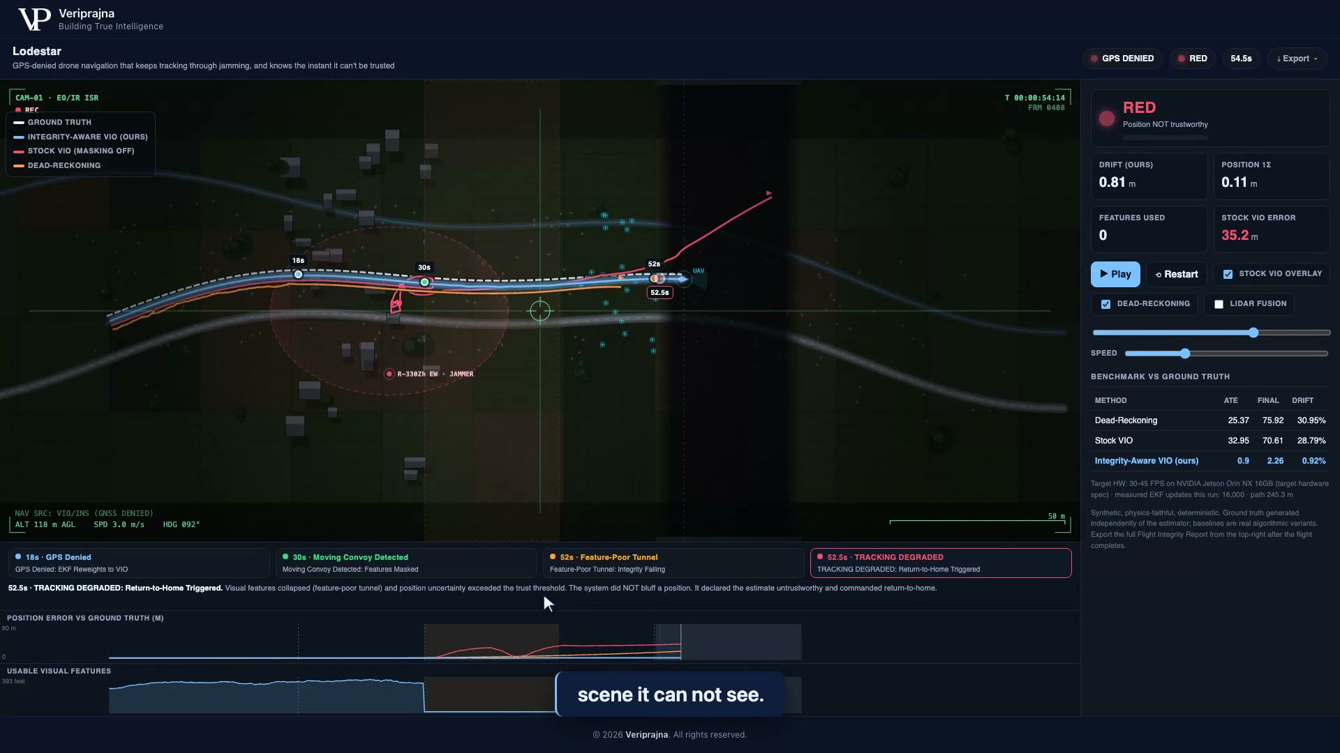
RED at 52.5 s
Return-to-home when the tunnel became unobservable
Same mission, LiDAR fusion off
100% / 0.1%
Unobservable tunnel flagged / false alarms on the healthy leg
Abstention check, this run
Everything below is a seeded, synthetic mission over a 245.3 m path, reproducible offline. No real drone, flight log, or electronic-warfare emitter is involved.
Electronic warfare has made GPS unreliable in exactly the places autonomous drones now matter most: contested airspace, mining pits, tunnels, urban canyons. The reflexive fix is to bolt on visual-inertial odometry (VIO) and hope. But VIO fails in two ways, and only one of them is the drift everyone talks about.
The first failure is that VIO drifts, accumulating error the longer GPS stays denied. That is manageable. The second is worse: VIO fails silently. It locks onto moving objects or an empty scene and reports a crisp, confident position that is simply wrong. For a defense, mining, or Blue UAS buyer, a confidently-wrong position is more dangerous than an honest "I don't know," because the aircraft acts on it with full conviction and flies precisely toward a place it is not.
When we built this demo, we treated that second failure as the real problem. Making the estimator more accurate does not solve it, because "is this position trustworthy?" is a different question than "what is this position?" You cannot answer the first with the same machinery that produced the second, any more than you would let a witness certify their own testimony. So Lodestar's durable value is not a better estimator. It is an integrity monitor that sits outside the estimator and is willing to say the unglamorous thing: this position cannot be trusted, return to home.
The pipeline is all real, deterministic, seeded code. A synthetic mission generates ground truth independently of every estimator; a tightly-coupled VIO EKF produces the position; a separate Navigation Integrity Monitor judges whether that position can be trusted; and a benchmark plus a Flight Integrity Report score the whole run against ground truth.
The same tightly-coupled VIO EKF runs in three genuinely different settings, not strawmen. Dead-reckoning IMU uses no vision. Stock VIO runs with semantic masking off. Integrity-aware VIO (ours) runs with semantic masking on, so it rejects the visual features that belong to moving objects instead of tracking them. When GPS is denied at t=18 s, the EKF hands off from GPS to vision with no operator-visible mode change and keeps the position continuous.
The Navigation Integrity Monitor is separate code on purpose. It fuses three signals into one integrity state with hard thresholds:
RED sustained for 0.5 seconds latches the failsafe and commands return-to-home. The monitor also reweights the GPS-to-VIO balance as trust changes. Because it lives outside the estimator, its verdict does not depend on the thing being trusted.
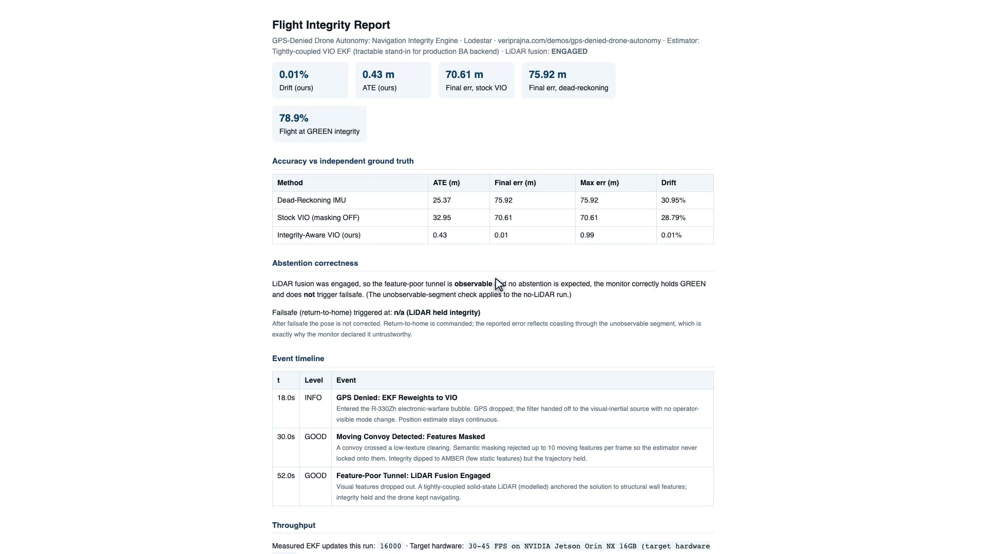
One click exports the audit receipt as JSON and printable HTML: the scoreboard, headline metrics, abstention correctness, failsafe time, an event timeline, and an explicit scope disclosure of what is stubbed versus deferred. It runs fully offline and deterministically at a fixed seed, so the entire result is reproducible. The only optional LLM is a "Draft narrative" button that writes the technical-review narrative from the structured report and sits entirely outside the flight loop; the deterministic integrity gate decides, the model only advises.
The demo is one continuous seeded mission. These are its four beats in order, recorded with LiDAR fusion off, the headline run where the failsafe fires.
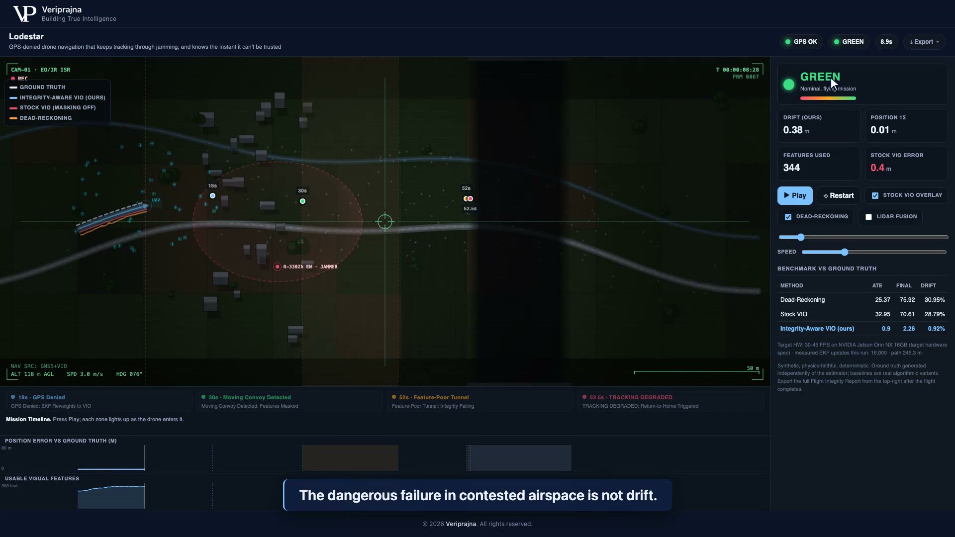
The drone crosses into a simulated R-330Zh-style electronic-warfare bubble and GPS drops. The EKF hands off to VIO with no mode change and keeps tracking to about 0.9% drift, while the dead-reckoning IMU baseline blows out to 30.95% drift and 75.92 m of final error. The accuracy is real, but it is not the point. The point is what happens when accuracy is no longer possible.
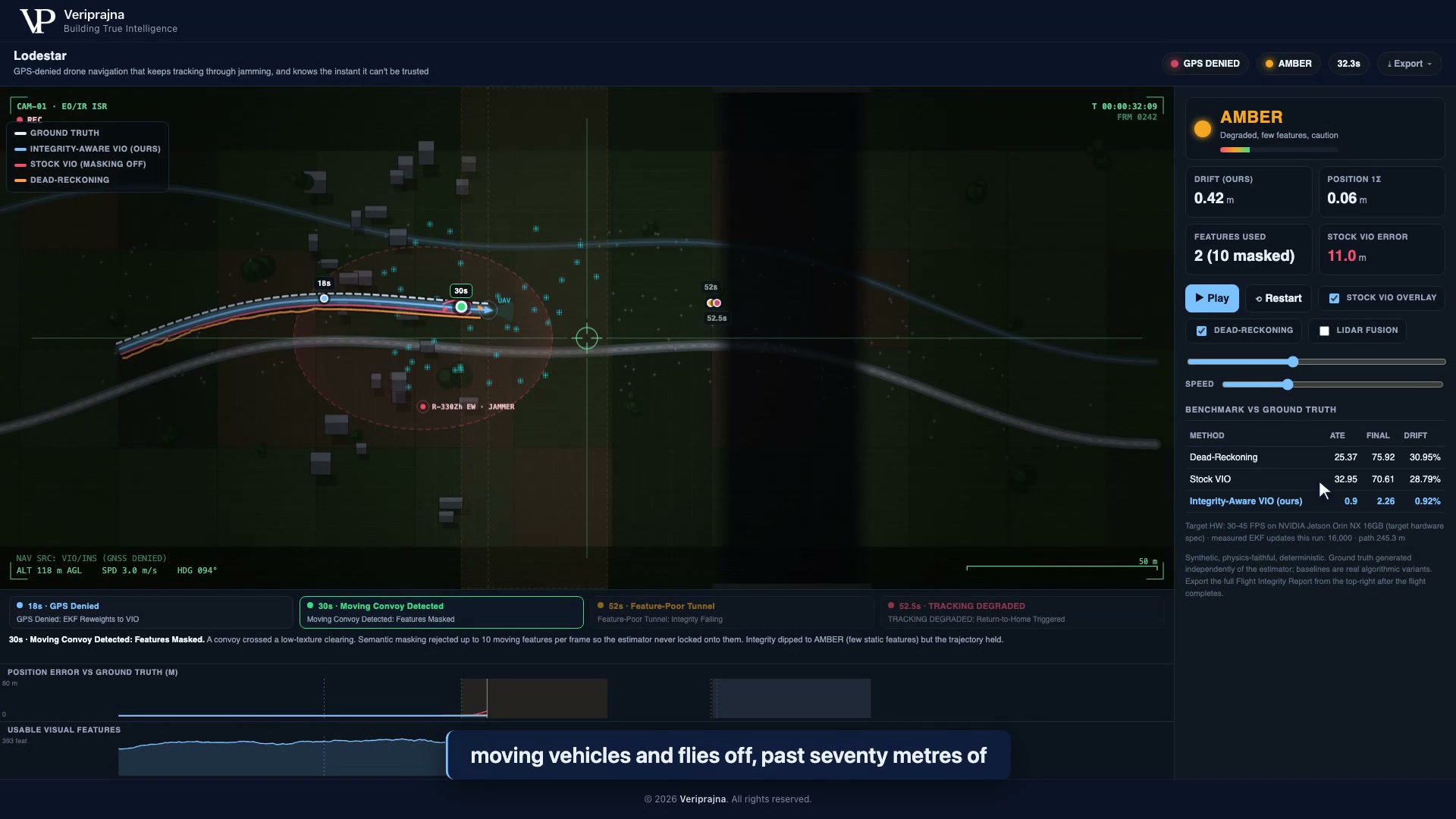
Produced by the report builder at seed 20260619 over a 245.3 m path, fully reproducible offline. The headline run is LiDAR fusion off, where the RED failsafe fires.
| Method (LiDAR off) | ATE | Final error | Drift |
|---|---|---|---|
| Dead-reckoning IMU | 25.37 m | 75.92 m | 30.95% |
| Stock VIO (masking off) | 32.95 m | 70.61 m | 28.79% |
| Integrity-aware VIO (ours) | 0.90 m | 2.26 m | 0.92% |
On the same run, 56.3% of the GPS-denied flight held at GREEN integrity, the monitor flagged the genuinely-unobservable tunnel 100% of the time, and it false-alarmed on the healthy GPS-denied leg only 0.1% of the time. The return-to-home failsafe triggered at t=52.5 s. With simulated LiDAR fusion on, the tunnel becomes observable, drift drops to 0.01%, GREEN coverage rises to 78.9%, and no failsafe fires, which is the correct behavior, not a missed one.
Throughput measured on this run was 16,000 EKF propagation updates (80 s at 200 Hz). The 30 to 45 FPS on an NVIDIA Jetson Orin NX 16 GB figure is a target-hardware spec, not measured here, and the report labels it as such.
Honesty is the product, so the scope is explicit. This is a demo of the mechanism, not a deployed pipeline.
When GPS drops inside a jamming bubble, Lodestar hands off to a tightly-coupled visual-inertial odometry (VIO) EKF that fuses camera landmarks and 200 Hz IMU data to keep estimating position. On our seeded synthetic mission that held drift to about 0.9 percent of the flown path, where a dead-reckoning IMU baseline blew out to roughly 31 percent. The estimator is only half the story: a separate integrity monitor decides, moment to moment, whether the position can be trusted at all.
A slightly drifting position degrades gracefully and an operator can plan around it, but a confidently wrong one sends the aircraft precisely toward a place that is not where it thinks it is. VIO fails this way when it locks onto moving objects or an empty scene and reports a crisp fix that is simply false. Lodestar's answer is honest abstention: when no position can be trusted, it says so and returns home instead of flying a confident-but-wrong fix into a wall.
In the dark-tunnel segment of our mission, usable visual features collapse to near zero, so no estimator can manufacture a trustworthy position. The Navigation Integrity Monitor flips to RED, and after 0.5 seconds of sustained RED it latches a failsafe and commands return-to-home, at t=52.5 s in this run. Toggle the optional simulated LiDAR fusion on and the same segment becomes observable again, so the monitor correctly holds and no failsafe fires.
It is a simulation. Everything is a synthetic, seeded mission with ground truth generated independently of every estimator, so the run is byte-for-byte reproducible; there is no real drone, flight log, or electronic-warfare emitter, and the R-330Zh is used only as a named scenario. What is real is the code: a working VIO EKF, the integrity monitor, and the benchmark all run deterministically offline. The durable claim is the structure, meaning trust computed outside the estimator and RED triggering return-to-home, not the exact metres of one mission.
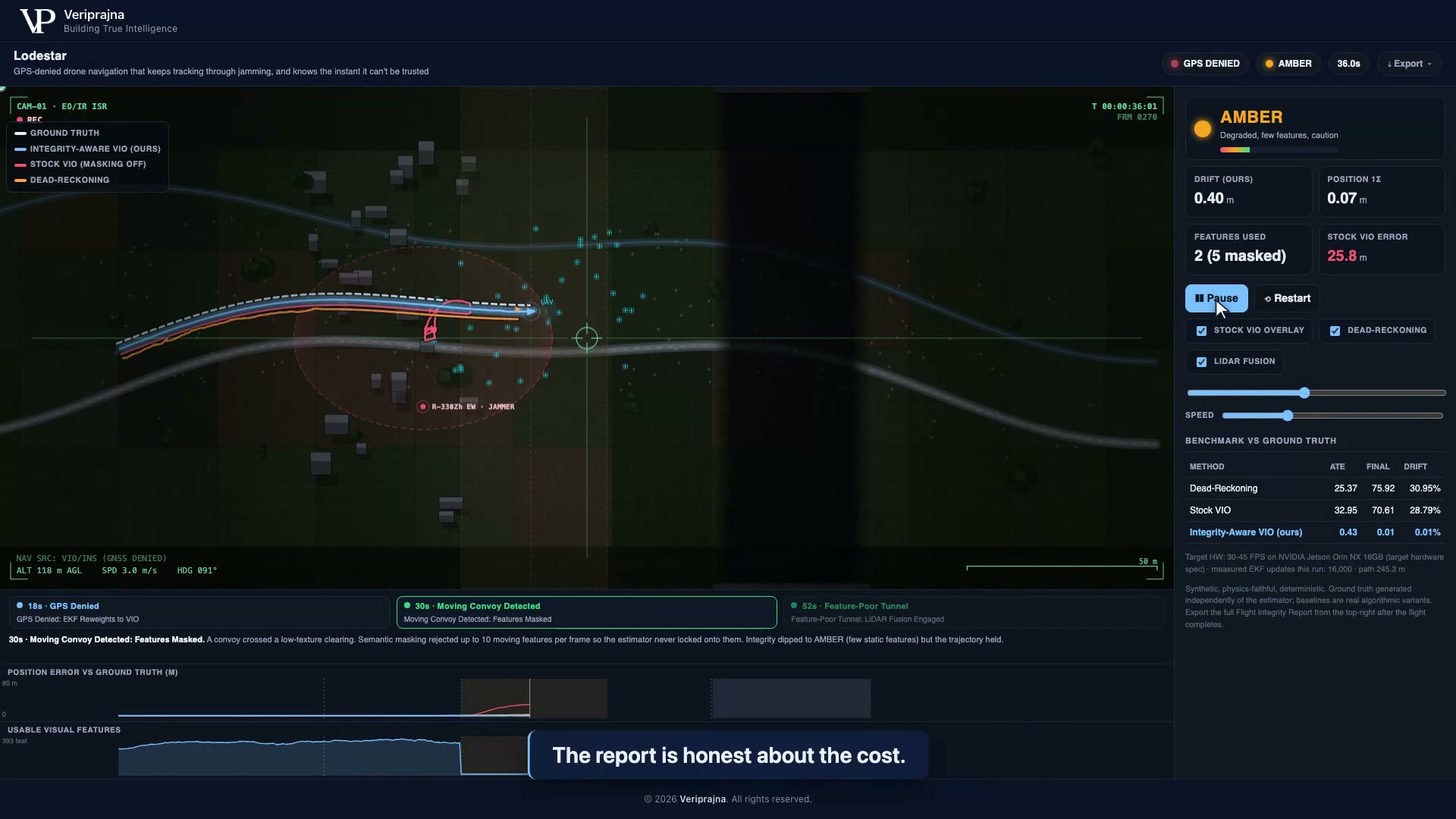
Stock VIO estimates position but has no separate judge of whether that position is trustworthy, and it can lock onto dynamic features. In the same seeded run, stock VIO with semantic masking off latched onto a moving convoy and flew off to about 29 percent drift, the classic case of tracking the truck and thinking the drone was still. Lodestar adds semantic masking that rejects the moving features, plus an integrity monitor that lives outside the estimator so trust does not depend on the thing being trusted.
The demo runs offline and deterministically on a laptop as a FastAPI service with a NumPy EKF and integrity monitor. The 30 to 45 FPS on an NVIDIA Jetson Orin NX 16 GB figure is a target-hardware spec, not a measured result, and the Flight Integrity Report states it as such. Onboard deployment, a real image front-end, and the autopilot/MAVLink bridge are deferred, not built in this version.
Blue UAS is the U.S. Defense Innovation Unit's cleared list of NDAA-compliant drones, and SBIR/AFWERX fund exactly this kind of GPS-denied autonomy work; we reference them as market context, not as affiliations. Veriprajna is not stated to be on any list or under any contract. What the demo provides for that kind of review is a one-click Flight Integrity Report with an explicit scope disclosure of what is stubbed versus deferred.
The research behind this demo — the architecture, the verification design, and the enterprise blueprint.
Full solution
Explore the GPS-Denied Drone Autonomy solution →The demo proves the mechanism. The harder work is adapting it to your platform, your sensors, and your mission.
If your team is wrestling with GPS-denied navigation and the question of when an autonomy stack should refuse to trust its own position, we would genuinely like to hear how you are thinking about it. The problem is industry-wide and the answers will be too.