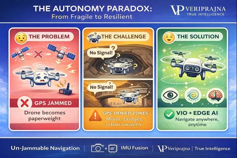
Imagine spending millions on a "smart" drone that stops working the moment someone turns on a $40 GPS jammer. That's the reality in Ukraine—and in your mining operations, infrastructure inspections, and industrial sites.
THE GPS FRAGILITY PROBLEM:
GPS satellites are 20,200 km away. Their signals reach Earth weaker than a light bulb from 10,000 miles. A cheap ground jammer overpowers them instantly. Your drone loses position, drifts, or crashes.
It's not just warfare. Underground mines have zero GPS. Bridge inspections create "GPS shadows" from multipath interference. Oil pipeline inspections cost $8.5M when failures happen—but your drone can't navigate under structures without satellite signals.
THE VERIPRAJNA SOLUTION:
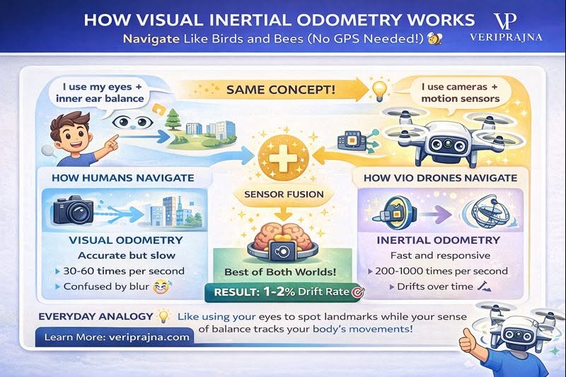
We build navigation like your body works—eyes (cameras) + inner ear (inertial sensors). Visual Inertial Odometry processes everything at the edge using NVIDIA Jetson AI.
No GPS needed. No cloud connection required. No jamming vulnerability. Just autonomous navigation that works in tunnels, under bridges, and in contested zones.
True autonomy isn't "automated until the signal drops." It's self-contained intelligence.
Connect with our solutions team to discuss GPS-independent navigation architectures.
📖 Read the full technical whitepaper here:
[Link in comments]
Connect:
📧 [email protected]
💬 WhatsApp: +919217059957
#DroneAutonomy #GPSJamming #EdgeAI #IndustrialDrones #MiningTech #InfrastructureInspection #AutonomousNavigation #BusinessTech #SmartSystems #Veriprajna