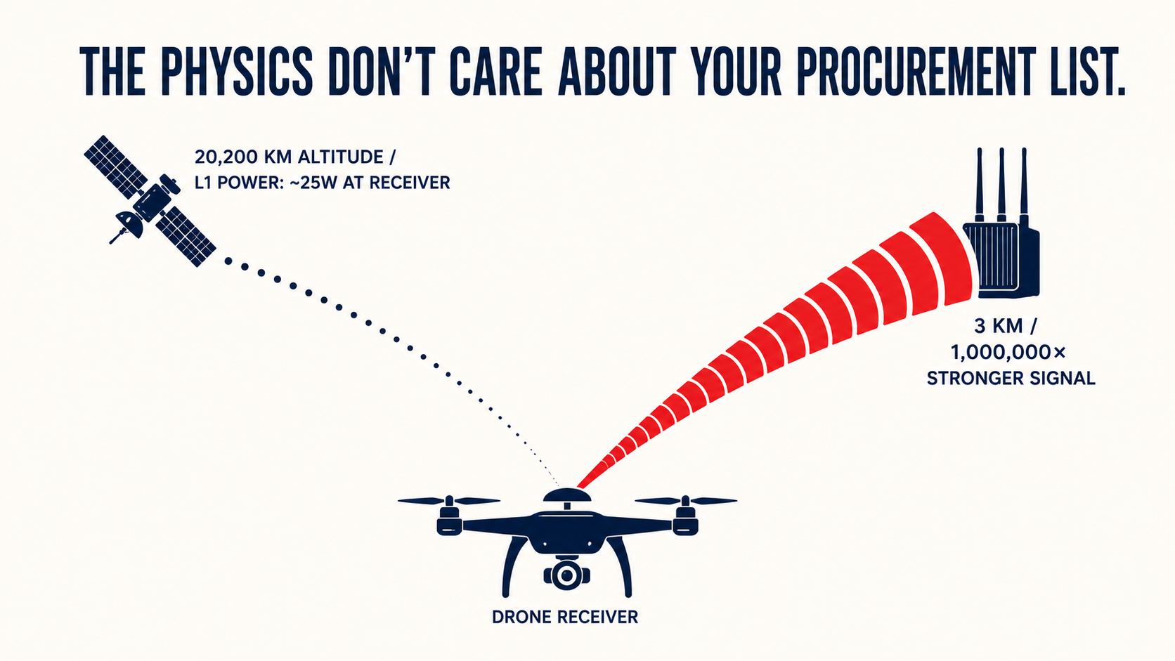
A GPS satellite broadcasts from 20,200 kilometers above the Earth; by the time the L1 signal reaches a drone's receiver, it carries roughly the power of a 25-watt bulb seen from 10,000 miles away. A ground jammer three kilometers from that airframe is, in path-loss terms, a million times closer—and every autonomy stack built on GPS as a primary navigation source has been built on the assumption that the weaker signal wins. The bottleneck in GPS-denied drone programs isn't cleared airframe availability. It's the Visual Inertial Odometry and SLAM integration that needs to run when the satellites go dark.
Three forces converged in 2024 and 2025 to make that integration work urgent and commercially real—and they're what drove us to build Veriprajna's GPS-denied drone autonomy stack. The physics were always there. The procurement and cost pressures are new.
When Ukraine Stopped Trusting GPS
Russian R-330Zh "Zhitel" jammers extend denial bubbles across 30-plus-kilometer zones along the front line. The operational data came back in IEEE Spectrum reporting and front-line operator dispatches: more than 50% of Ukrainian FPV drones are reported downed by electronic warfare jamming, with some units reporting 31% sortie loss rates. One documented response was simple and drastic—front-line teams now build airframes that ship without GPS receivers, because GPS is no longer assumed to be present.
The lesson the research community drew wasn't that drones fail in contested environments. It was that drones without an independent position reference become expensive objects that drift and crash. The engineering vocabulary shifted: operators stopped asking how to improve GPS lock and started asking what to navigate with when GPS isn't there.
A drone losing GPS in a contested electromagnetic environment isn't slower or less accurate. It's navigating blind.
The same problem scales down to civilian use cases where there's no jammer involved. An inertial measurement unit running open-loop in an underground mine shaft—no external position reference—drifts because position is computed by double-integrating acceleration, and any measurement error accumulates as t-squared. A consumer-grade MEMS IMU left to run free in a tunnel drifts meters within seconds. The $1 billion per day that NIST and RTI International estimated as the economic cost of a US GPS service outage is, in part, a catalog of exactly these use cases: financial timing, pipeline monitoring, underground inspection—infrastructure that stops functioning when satellite signals degrade.
What the FCC Action Did—and Didn't Resolve
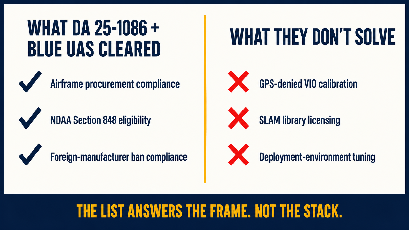
On December 22, 2025, the FCC added all foreign-produced unmanned aircraft systems and UAS critical components to its Covered List in public notice DA 25-1086—going substantially further than the FY2025 NDAA mandate, which had targeted DJI and Autel specifically. New equipment authorizations for any foreign-made UAS or critical component are now blocked.
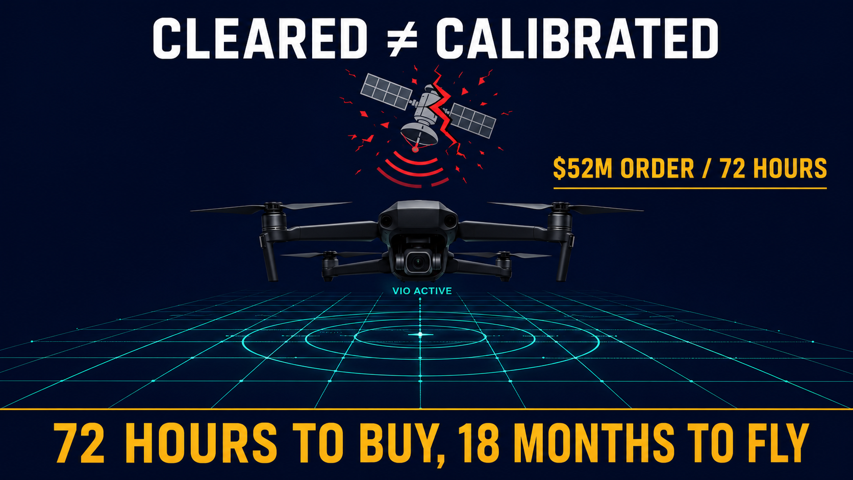
The procurement effect was sharp. Federal customers, defense primes, and grant-funded municipal programs lost access to the foreign UAS supply chain for new procurement plans. The Army's March 22, 2026 award of $52 million for 2,500 Skydio X10D drones—the largest single-vendor small UAS contract in Army history—closed bid-to-award in under 72 hours, not because the procurement process was fast, but because the cleared inventory of GPS-denied capable platforms was small enough that there weren't many places to send the contract.
The Blue UAS Cleared List—the DoD's designation for NDAA-compliant domestic-manufactured platforms—now managed by DCMA's US-X command at Palmdale following its December 2025 transfer from DIU, has more than 50 approved platforms—Skydio X10D, ModalAI Starling 2, Freefly Astro Blue, Anduril Ghost-X among them. What the list answers is the airframe compliance question. It doesn't answer what happens when those frames are delivered to a program office that needs them to navigate GPS-denied underground mine shafts, bridge inspections in GPS shadows, or contested operational environments where nobody told the hardware to expect satellite denial.
Where Integration Projects Break
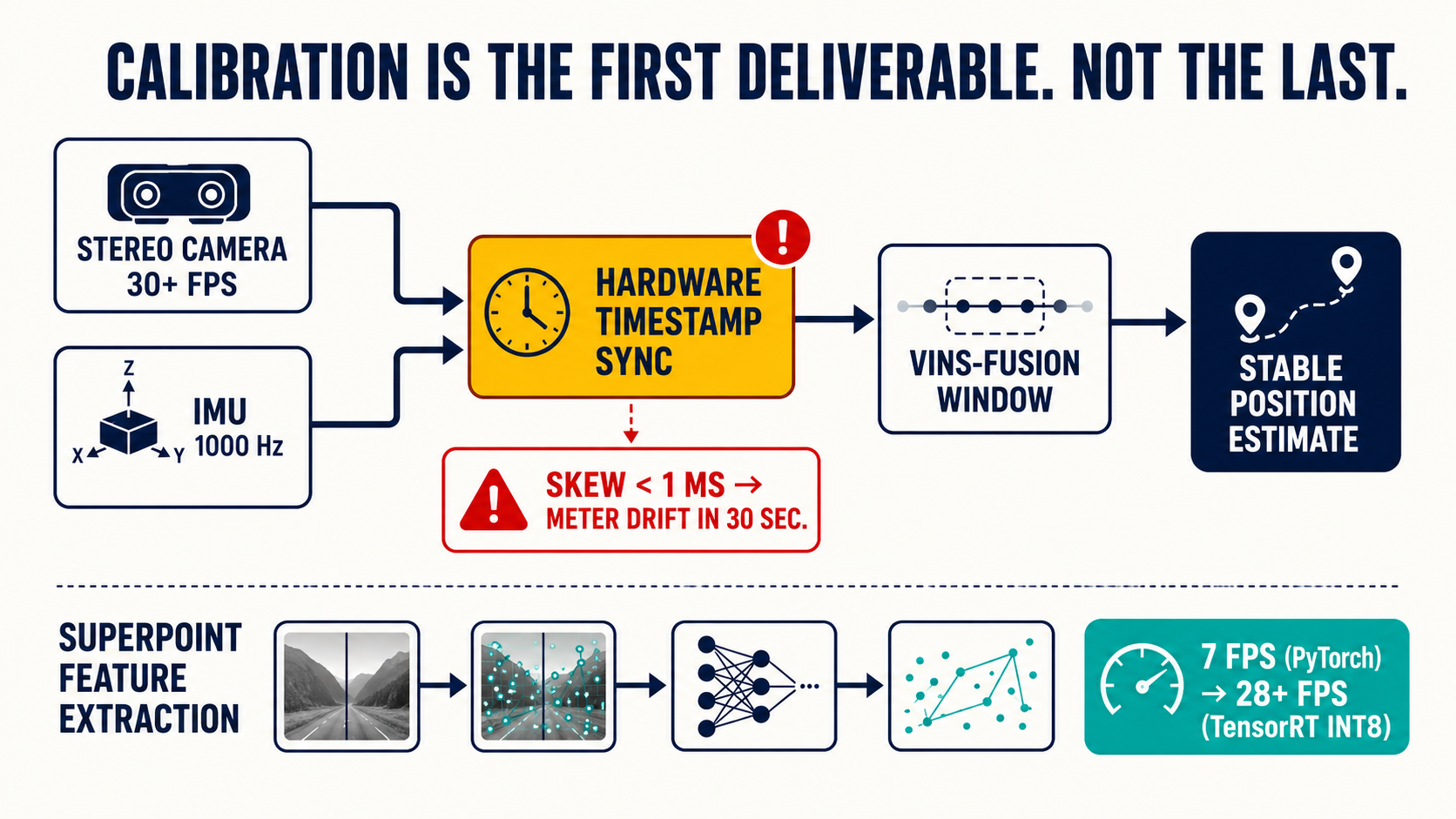
Sensor calibration is where most GPS-denied drone programs fail their first flight review. A stereo camera pair whose IMU and image timestamps are misaligned by even a single millisecond will corrupt the optimization window in VINS-Fusion. Position estimates drift at meter-per-second scale within thirty seconds of flight. What makes this failure mode systematic is that it almost never appears during bench testing—the IMU noise doesn't accumulate fast enough in a short session to show. The operator finds the calibration gap when the airframe encounters a wall in a mine shaft or drifts off-station during a bridge approach.
A one-millisecond timestamp skew between IMU and stereo camera doesn't appear on a bench test. It appears as a meter of position error thirty seconds into the first real flight.
Open-source licensing is the other thing that reliably surprises programs late in the integration. ORB-SLAM3 is the most widely cited starting point for visual SLAM work—strong academic benchmarks on the KITTI dataset, active maintenance, documented multi-map and visual-inertial modes. It is also GPLv3. A commercial closed-source product that ships ORB-SLAM3 as a linked library is technically in violation of that license. The point of discovery is almost always a SBIR (Small Business Innovation Research) Phase II final deliverable review, when the architecture is already locked. The alternatives each carry different tradeoffs: NVIDIA Isaac ROS cuVSLAM is free, GPU-accelerated, and Jetson-optimized; VINS-Fusion ships under Apache 2.0; a SuperPoint front-end with a permissive license brings better feature matching at the cost of additional TensorRT optimization work. The license decision belongs at architecture phase, not at delivery.
On compute, the Jetson Orin NX at 100 TOPS is the balance point for combined VIO and semantic SLAM on a weight-constrained payload. Baseline SuperPoint feature extraction runs at 7 frames per second in PyTorch—too slow for the 30-plus FPS that stable position hold requires. TensorRT INT8 quantization reaches 28 FPS and above. The calibration catch is specific: the INT8 quantization calibration dataset has to reflect the actual deployment environment. A mine-tuned model calibrated against dark stope imagery performs correctly underground. The same model calibrated on KITTI road sequences loses accuracy on the first enclosed flight.
The Commercial Math That Doesn't Require a Defense Scenario
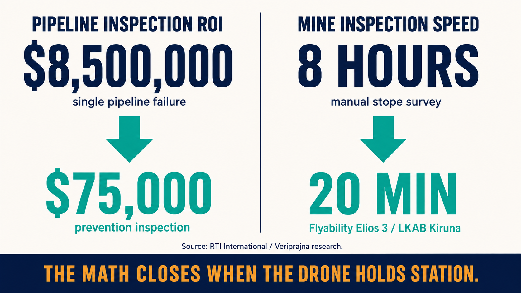
LKAB's Kiruna iron ore operation replaced an eight-hour manual stope inspection with a 20-minute Flyability Elios 3 flight. That ratio generalizes across most confined inspection use cases—a manual survey crew costs thousands per day, and a drone mission covers the same volume in 30 minutes to two hours. The structural limit on that ROI is whether the drone can hold station in GPS-denied airspace.
The liability math is harder to argue with. A single oil and gas pipeline failure runs $8.5 million in cleanup, regulatory penalties, and remediation, against a $75,000 routine drone inspection that would have caught the corrosion. A non-autonomous drone that can't hold position in a GPS shadow beneath a steel bridge doesn't complete that inspection—it collects footage at the wrong angle and produces a photogrammetry dataset that can't support a structural assessment. Industrial drone platforms cost $10,000 to $50,000 to replace; a first-flight crash in a confined mine shaft on a frame without functioning VIO is a total loss. Operators learned that arithmetic before their vendors did, which is why the demand for GPS-denied autonomy in commercial inspection contexts is almost always driven by teams who have already crashed something expensive.
Where the Engineering Gap Actually Sits
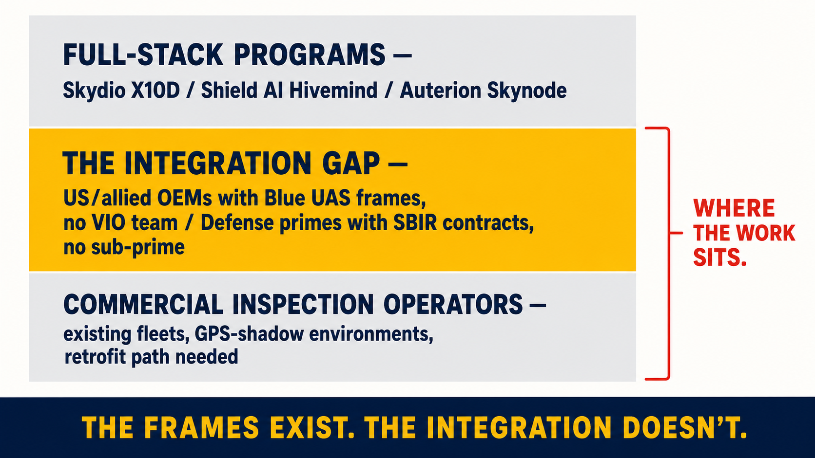
Our GPS-denied drone autonomy work isn't positioned against Skydio's closed proprietary stack or Shield AI's Hivemind autonomy infrastructure—both are full-stack programs with institutional backing. Auterion, whose platform shipped 33,000 Skynode AI strike kits to Ukraine under a $50 million Pentagon contract, operates at a different scale. The gap those programs don't fill is the mid-tier integration work.
US and allied OEMs with Blue UAS certified frames and no deep VIO/SLAM team. Defense primes pursuing SBIR, STTR, or AFWERX awards who need an embedded computer-vision sub-prime with platform knowledge. Mining and infrastructure operators who own existing fleets a generation behind the autonomy standard and can't justify a full Emesent Hovermap ST-X replacement cycle. For these programs, the ORB-SLAM3 licensing decision, the TensorRT INT8 calibration pipeline, and the PX4 VISION_POSITION_ESTIMATE integration with ArduPilot EKF3 represent twelve to twenty-four months of engineering compressed into a delivered, flight-tested payload.
The DoD's Replicator Initiative documented the same gap at program scale: hundreds of autonomous systems procured, software to command heterogeneous swarms in short supply. The cleared frames are increasingly not the scarce resource. The autonomy integration work is.
If your team is working through Blue UAS autonomy payload options, a commercial inspection retrofit, or an SBIR positioning that requires GPS-denied navigation as a key performance parameter—we'd find it useful to hear what the operational environment actually looks like. The calibration and licensing questions tend to be environment-specific in ways that matter early in the design, and what we've learned across defense and industrial programs is worth more shared than kept internal.